For over a decade, the University of Houston Coastal Center (UHCC), located in La Marque, Galveston County—roughly a 50-kilometer drive south of the UH main campus—has served as a premier outdoor classroom, transforming the education of thousands of graduate and undergraduate students from the Department of Earth and Atmospheric Sciences (EAS). Designated by the Texas Legislature as the home of the Texas Institute for Coastal Prairie Research and Education, the center offers an ideal backdrop for experiential learning. The UHCC’s diverse landscapes—from active energy infrastructure and a unique GPS array to groundwater wells, wetland ponds, and the open skies essential for UAV training—provide an unparalleled living laboratory for students to witness Earth processes in action across the coastal prairie.
Over the past 10 years, Professor Guoquan (Bob) Wang has utilized the UHCC as a premier site for research and education. Each semester, Dr. Wang leads a one-day field trip for students from his courses, including GEOL3320/6391 Principles of Geophysics and GEOL6324 GPS Geodesy in the fall, and GEOL4332/6323 Geoscience Applications of GPS and LiDAR in the spring. This one-day field trip is designed to bridge the gap between theoretical geophysics and its critical real-world applications. After a peak of over 100 students per trip in the mid-2010s, enrollment has seen a strong resurgence, a trend correlated with a downturn in the traditional oil and gas job market. Participation has grown steadily, reaching 45 students in the Fall 2025 semester. Over the past decade, this field trip has provided over a thousand UH students with an irreplaceable, hands-on understanding of energy systems, hydrological cycles, geodetic monitoring, and ecosystem dynamics.
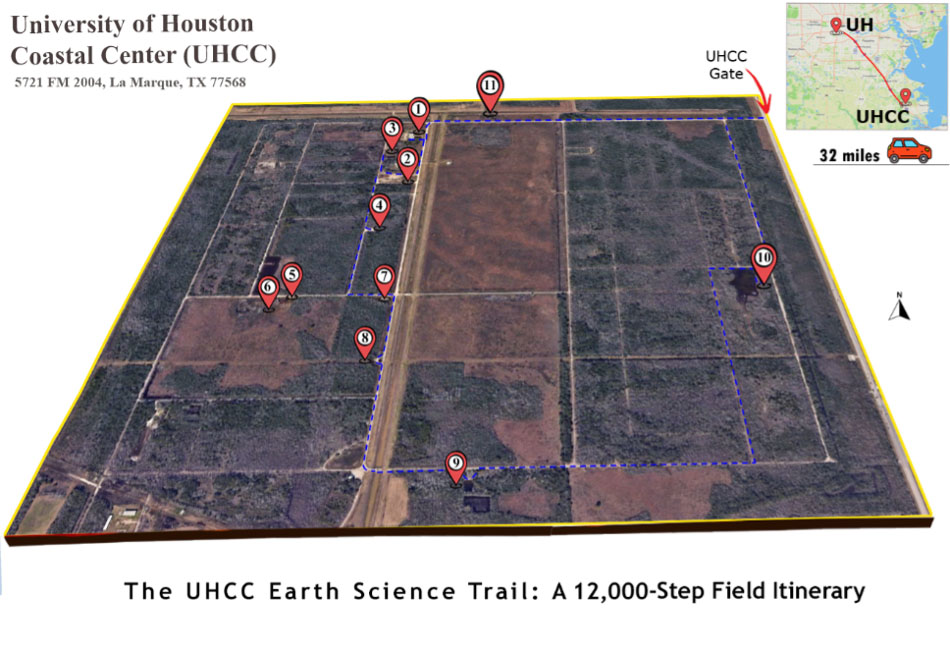
The 2025 Fall Field Trip: A Tradition Continues
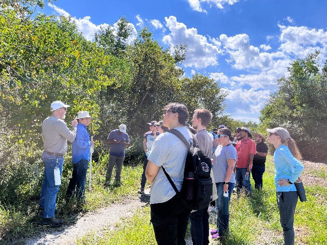
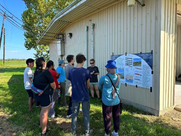
On September 27, 2025, this tradition continued as the UHCC buzzed with the activity of approximately 45 students from courses including GEOL3320/6391 Principles of Geophysics and GEOL6324 GPS Geodesy. The day's activities featured a 3-hour, 12,000-step (approx. 5-mile) walking tour of 11 distinct field sites, followed by a 2-hour hands-on practicum, providing a comprehensive overview of the center's role as a unique coastal living laboratory for Earth and environmental sciences. The field trip's curriculum was structured around five core educational stations, offering a comprehensive journey through the living laboratory.
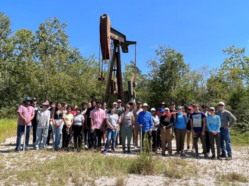
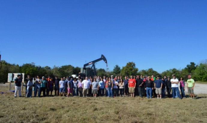
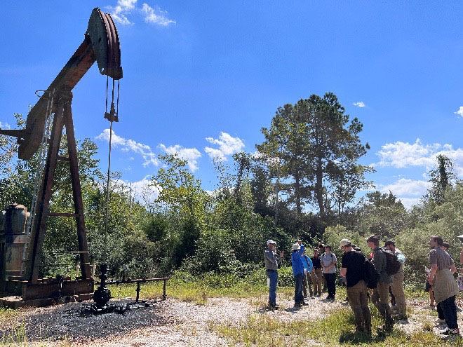
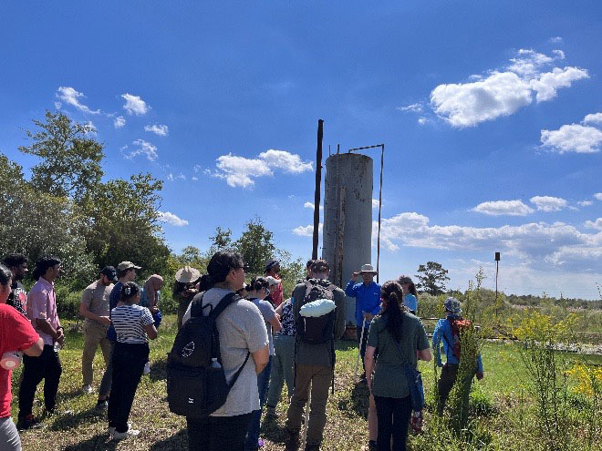
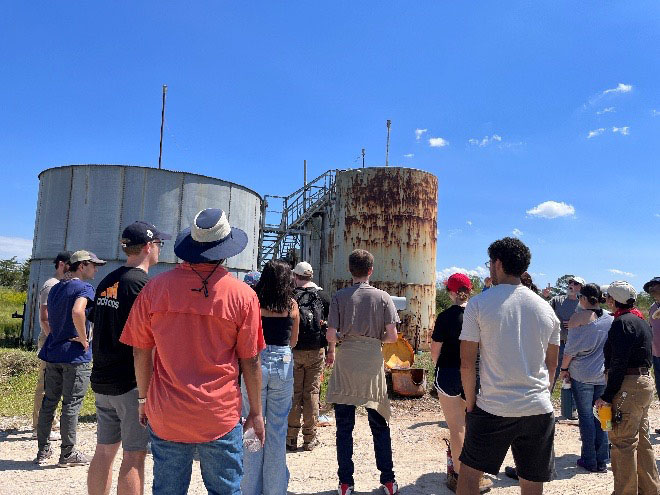
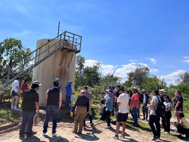
1. Energy in Action: Urban Oil & Gas Operations
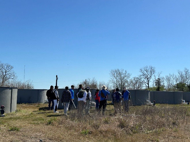
The UHCC offers a rare and critical opportunity for students to observe the complete operational workflow of hydrocarbon production within an urban setting. This area, part of the larger Texas City-Galveston County region, has a rich history of oil and gas exploration dating back to the early 20th century, playing a pivotal role in the industrial development of the Texas Gulf Coast. Students witness the entire process—from extracting the oil-water-gas mixture, to separating the hydrocarbons, and finally to injecting the produced saltwater back into deep geological formations.
- Active Oil Well: Students observe a continuously operating oil well, tracing the path of hydrocarbons from the pumpjack (Donkey head) and the constant flare (Torch), through a network of pipes to the separating tower, and finally to the storage tanks.
- Gas Well Conversion: Students also visit a well that has been converted from oil to gas production, illustrating the industry trend of maximizing the utility of existing infrastructure. They learn about enhanced recovery techniques like CO₂ injection and the pathway of gas into the public utility system.
- Produced Water Management - The Why Behind Salt Water Disposal (SWD): A key stop on the tour is the Salt Water Disposal (SWD) site, where the critical practice of injecting produced water—the brine extracted alongside oil and gas—back deep underground is discussed. The discussion emphasizes that this process is not mere waste disposal, but a complex environmental and operational necessity. Students are encouraged to explore the primary reasons for this practice, which include Environmental Protection, Reservoir Pressure Maintenance, Subsidence Mitigation, and Regulatory and Economic Compliance.
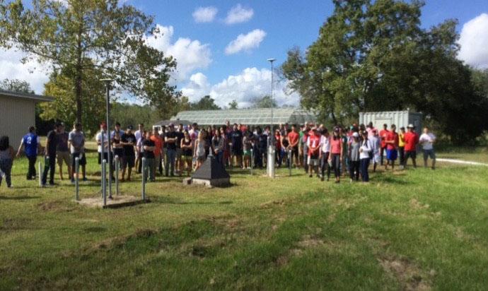
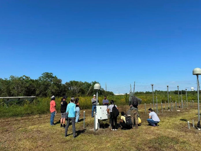
2. Tracking the Earth Move: GPS & Ground Deformation
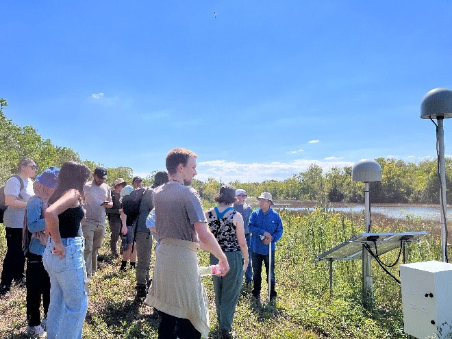
A decade-long research and educational project at the UHCC is a unique GPS array designed and installed by Dr. Wang’s team in 2014. This network of seven permanent stations is a powerful tool for studying ground deformation.
- Depth-Dependent Compaction: The GPS antenna poles are anchored at different depths below the surface, allowing scientists to delineate how much compaction and subsidence occurs within specific sediment layers.
- Drought Impact: The surface station has recorded significant subsidence during drought years of 2022 and 2023. This data was crucial for a groundbreaking study led by Dr. Wang’s current Ph.D. student, Jennifer Welch, which unveiled "drought-induced inelastic subsidence" in expansive soils. Her research, published in Geophysical Research Letters demonstrated how drought can cause permanent loss of elevation in coastal lands, a critical finding for coastal resilience planning.
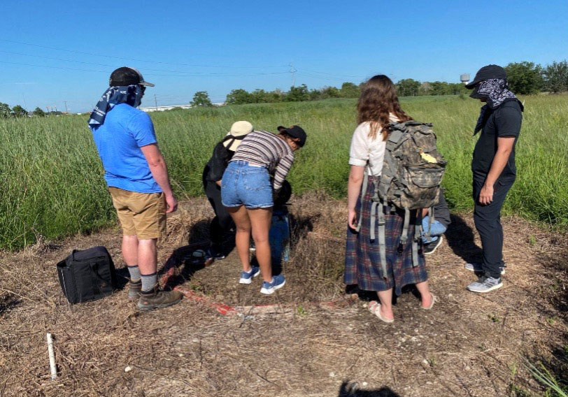
3. Beneath the Surface: Groundwater Dynamics
Understanding the complex hydrogeology of a coastal environment is a core objective of the field trip. The UHCC hosts a series of monitoring wells that tap into different subsurface units, providing a hands-on lesson in the vertical distribution and behavior of groundwater.
Students work in small groups to measure the depth to water in wells screened at various depths. A key revelation is discovering that two closely-spaced wells can have dramatically different groundwater levels. This exercise demonstrates the critical difference between unconfined and confined aquifer systems:
- The Water Table: This is the shallowest water level, separating the dry soil and wet soil. Above it lies the unsaturated zone, where pore spaces contain a mixture of air and water. Below it is the saturated zone, where all pores are filled with water. Students measured the water table at approximately 3 meters below the land surface in several shallow wells at the UHCC.
- The Potentiometric Surface: This represents the hydraulic head within a confined aquifer. It is measured directly as the depth to water in a well terminated in the confined Chicot aquifer. Students recorded this level at about 25 meters below the land surface in the confined aquifer. Long-term trends from over a decade of groundwater measurements will be analyzed further in the classroom.
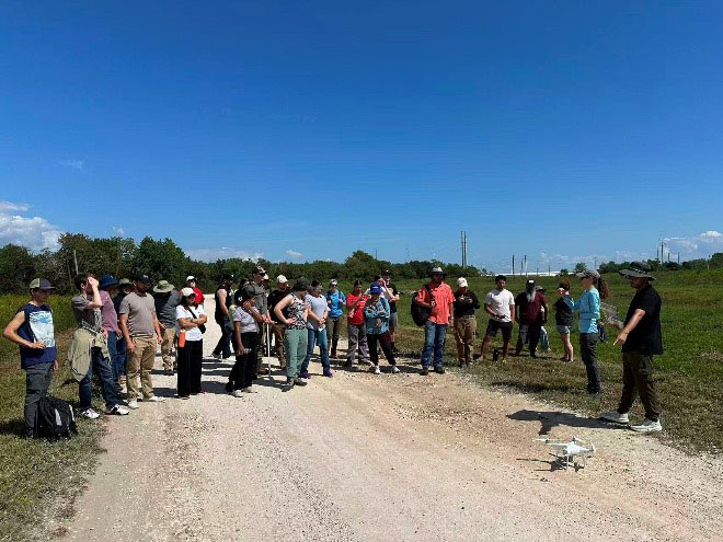
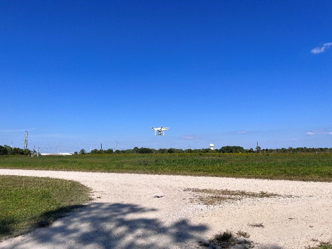
4. A Secure Airspace for UAV Mastery
The UHCC provides a rare and invaluable resource for modern geoscience and remote sensing education: secure, open sky for Unmanned Aerial Vehicle (UAV) operations. This is a critical advantage over urban campuses, where flight is often restricted or impossible due to airspace regulations and safety concerns. With the campus gates locked during the field trip, students practice flight operations in small groups within a controlled, safe environment. This session focuses on the transformative applications of UAV photogrammetry for creating high-resolution 3D models and multispectral remote sensing for environmental monitoring, giving students hands-on experience with a technology that is rapidly reshaping data collection in the broader geophysics fields.
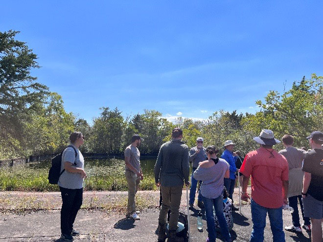
5. Interdisciplinary Connections: Wetlands, Biology, and History
The field trip is designed to foster a holistic understanding of the environment, connecting geoscience to biology and local history.
- Wetland Monitoring: A small inland wetland pond on the campus is a hub for biological and environmental research. Dr. Wang’s team has installed two GPS stations at its margin to study how the ground deforms in response to weather conditions and changing water levels in the pond, linking weather, hydrology to earth surface deformation.
- Reserve Coastal Prairie and Ecological Threats: During the tour, Dr. Wang highlights the threat of invasive species, particularly the Chinese Tallow tree. Students learn how this aggressive plant outcompetes native prairie grasses, surviving floods and fires that would kill native species, and threatening the conservation efforts of the coastal prairie.
- A Walk Through History: The 12,000-step tour across the campus also delves into its rich past. Students learn that the UHCC was once a major military campus during World War II, used for training soldiers and assembling weapons, adding a layer of human history to the geological and ecological landscape.